It’s time for Meteo Monday, and this week we’re going to get cold and wet as we take a look at ice jams! Although “ice jam” sounds like the name of a punk rock band, it is a destructive meteorological phenomenon.
https://www.youtube.com/watch?v=VEq2CDtAp3s
Ice jams are sometimes referred to as “ice dams,” which is essentially what they are. They are most common in late winter and early spring. If a river is frozen, the warming temperatures (usually coupled with heavy rainfall) will cause the ice to break up. The river then carries the large ice chunks downstream. What happens when this ice collides with an obstacle in its path, such as a bridge, a fallen tree, or sometimes just a narrow passage in the river? The ice will “jam up” beneath or around the offending object(s).
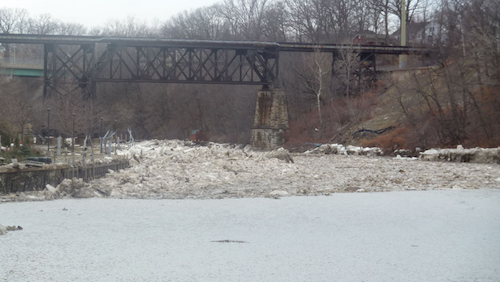
Once an ice jam occurs, the river’s water has nowhere to go. Thus it backs up and will inundate the area with cold, icy water. Flooding doesn’t just occur upstream of the blockage. Sometimes if the dam bursts, all of the water that was backed up is now forced through and will cause flooding downstream.

When the ice jam is broken up, and the water recedes, the area that was once flooded will often be littered with “ice cakes.” These chunks of ice are shaped like slices of cakes. However, they are not edible.

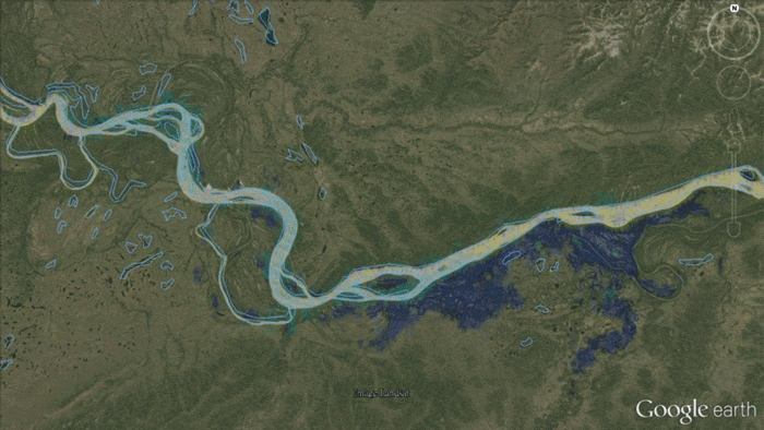
According to the National Oceanic and Atmosphere Administration (NOAA), weather satellites can help monitor the progress of flooding caused by ice jams. They state: “Satellites in the Joint Polar Satellite System (JPSS) orbit the Earth from pole to pole, eventually seeing every part of our planet twice a day. One JPSS instrument, called the Visible Infrared Imaging Radiometer Suite (VIIRS), can capture images of surface water on Earth. Because JPSS passes over each location on Earth approximately every 12 hours, the data it collects can show how a flood is progressing and where flooding is the worst. This information can assist local emergency responders in figuring out which areas they’ll need to help first.”
Sources: