The Storm Report

  • Home
  • Radio Weather
  • Staff
  • Interactive Radar
  • Contact Us

March 1, 2021 By Nick Wilkes

Getting Ready For Severe Weather Season!

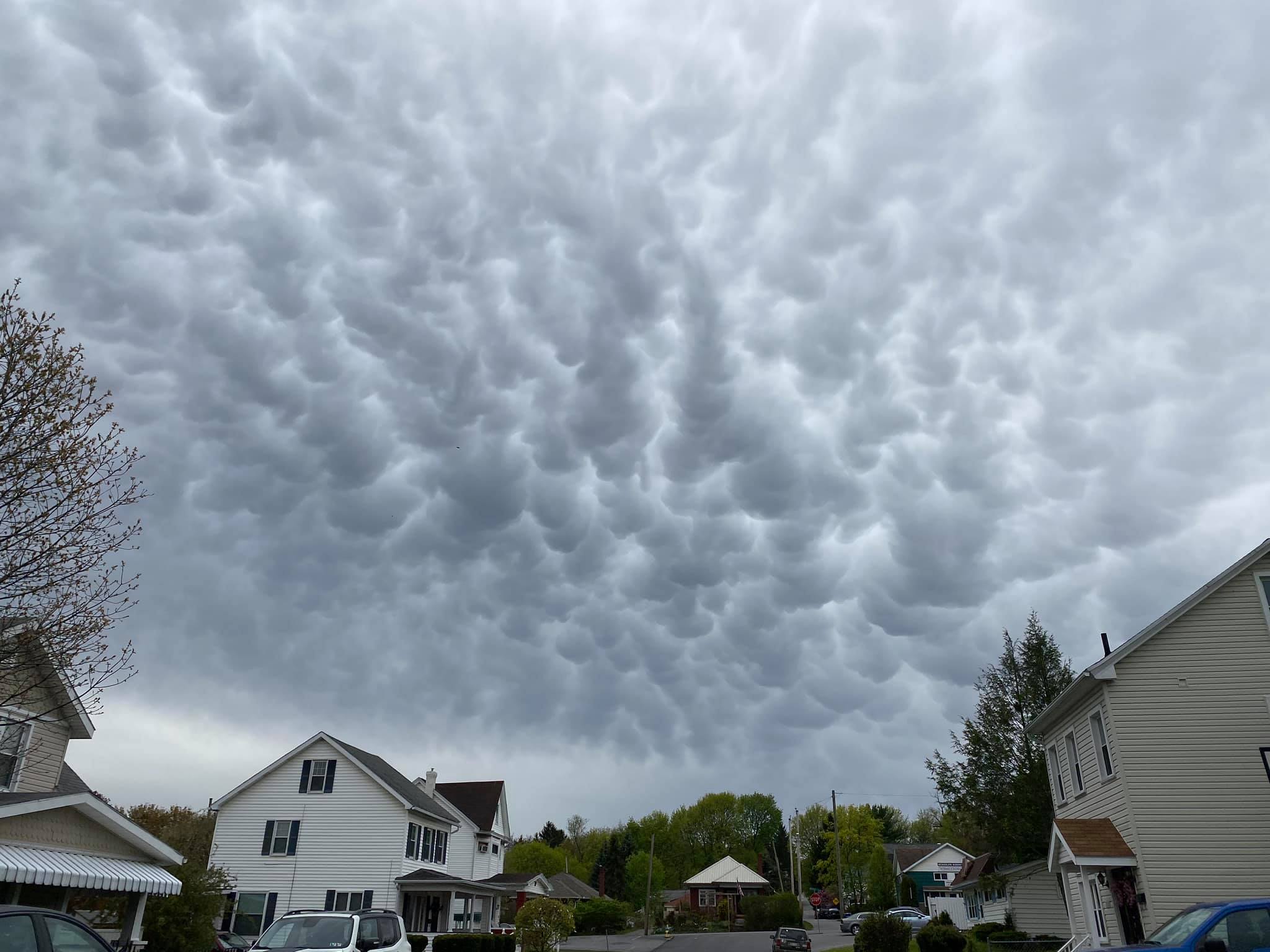
It’s official, today is the first day of Meteorological Spring, and you know what that means; we start thinking about spring storms and the risk of severe weather. There are some important things to address before the storms start firing up. What is the difference between a watch and a warning? What are the different ways to receive these warnings? What do you need to do to stay safe? We will find out in this week’s Meteo Monday. 


A severe thunderstorm approaching Greensburg, PA, on June 20, 2015. Photo taken by the author.

Watch VS Warning

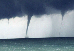
The two main types of watches issued during severe weather season are severe thunderstorm and tornado watches. The Storm Prediction Center (SPC) issues these watches. A watch is issued when conditions are ripe for severe storm development. If the conditions in place suggest the primary storm mode will be tornadic storms, the SPC will opt for a tornado watch instead of a severe thunderstorm watch. 

A watch means that dangerous storms are expected to happen within a particular area; though one thing to note, it doesn’t mean everyone inside the watch box will get a bad storm. When a watch is issued, you can go on about your daily routine; but, you should pay closer attention to the weather that is going on, and you should be prepared to seek shelter if the watch is upgraded to a warning. 


Photo showing a severe thunderstorm watch issued by the SPC.

Photo showing a tornado watch issued by the SPC.

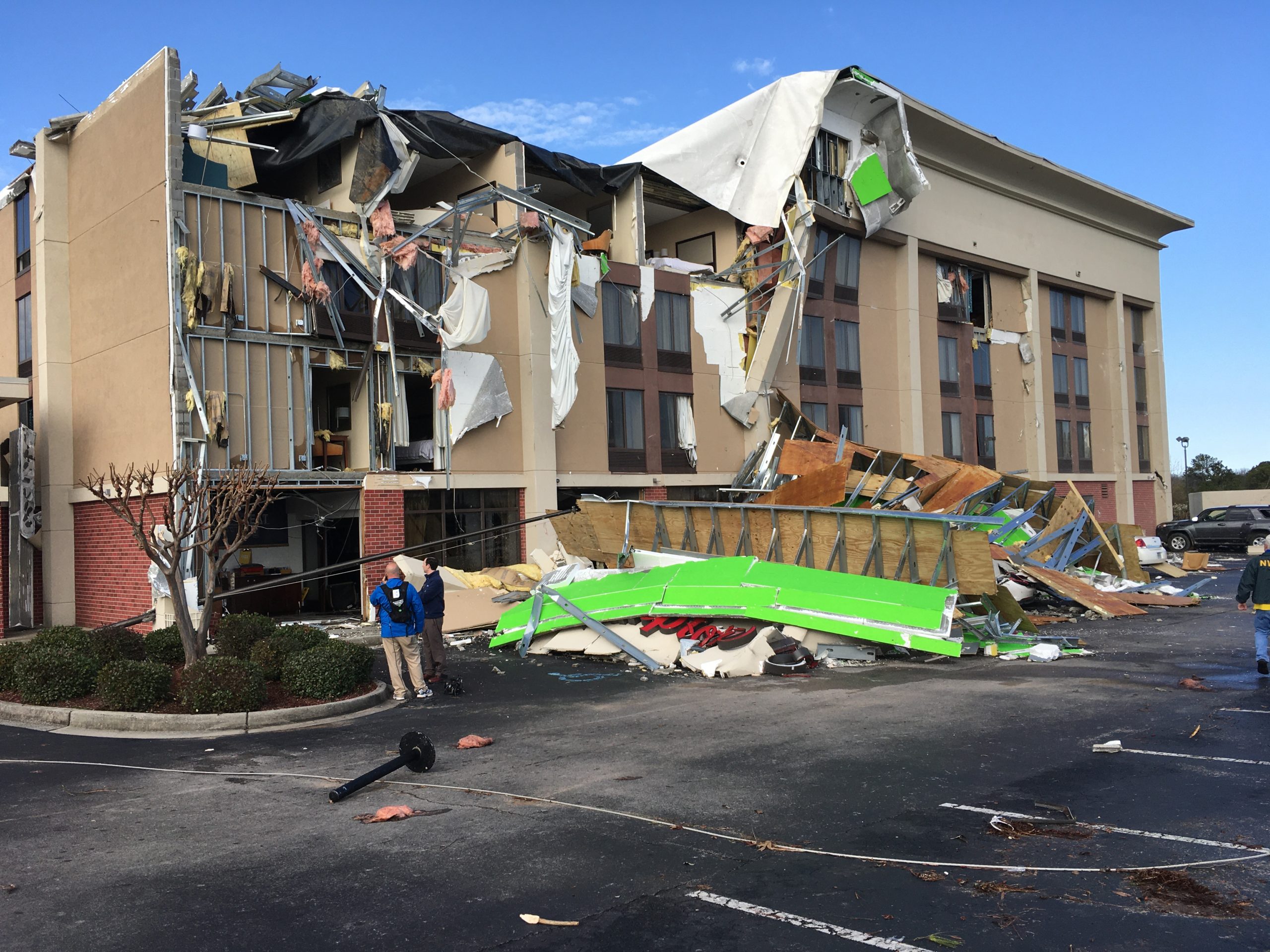
A warning is issued when severe weather is occurring or imminent. Warnings are issued by local National Weather Services (NWS) offices. Per the NWS, a severe thunderstorm warning will be issued if the storm is capable of producing at least one of the following criteria: “winds of at least 58 mph (50 knots or ~93 km/h), and/or hail at least 1″ in diameter.” Just because a storm is producing a lot of lightning doesn’t automatically make it a severe storm. A warning will not be issued unless one of the above criteria is being indicated by radar.  

It is also possible to have a severe thunderstorm warning without having any lightning or thunder. If a line of showers reaches the above criteria, a severe thunderstorm warning will be issued. This happens fairly frequently across the Mid-Atlantic, in the early spring and late fall, when you get a low-topped squall line that forms along a cold front. These often produce damaging winds over 70 mph but usually produce little to no thunder and lightning. 

Another thing to note is that in some cases if there is broad, weak rotation in a storm, a “tornado possible tag” is added to the warning.  If a severe thunderstorm is showing signs of strong rotation, a tornado warning will be issued. Severe thunderstorm warning criteria do not need to be met for this. As long as the storm is showing signs of strong rotation on the radar, a tornado warning will be issued. 


Photo showing a severe thunderstorm issued by the NWS.

Photo showing a tornado warning issued by the NWS.

How to Receive Warnings 

When it comes to receiving severe thunderstorm and tornado warnings, it is recommended that you have more than one way to obtain the warnings. If the cell phone towers go out, you might not be able to receive alerts that way, or perhaps the tornado sirens in town aren’t working. So you shouldn’t be relying on one method. 

Arguably the best way to receive warnings is from the NOAA Weather Radio. You can pick up a weather radio for as low as $20 from your local Walmart, or you can choose from several different models online. This has been a tried and tested method since the late 1970s. The loud sounds that these emit before reading you the warning are loud enough to wake you if there is a nighttime severe weather warning. 


Two different weather radios, via Wikimedia Commons.

Smartphones are another great way to receive warnings. All modern phones are equipped to receive Wireless Emergency Alerts (WEA). The WEA will sound for tornado warnings, snow squall warnings, and hurricane warnings.  If a tornado warning is issued for the area you are in; it will ping the cell phone tower you’re connected to and then transmit to your phone. You shouldn’t rely just on the WEA on your phone; you should have another app on your phone to receive other warnings for flooding, severe thunderstorms, or even winter weather. We recommend the FEMA app, which will send any type of weather alert to your phone. You can download the FEMA app here for iPhone or here for Android. The FEMA app also lets you monitor several locations, so you can keep tabs on alerts that may come across for family members on the other side of the country!  You can also download an app from your favorite local news station and use that as a way to receive push notifications for severe alerts.


Screenshot of several push notifications from different apps, as well as a WEA showing a tornado warning for the author’s location on May 28, 2019.

When you think of a tornado warning, you might instantly think of tornado sirens. These are a staple in the tornado-prone communities of the United States. These, however,  are the least reliable method of receiving a warning. Tornado sirens can often go out during severe weather due to power outages and lightning strikes. Their sound can also be obscured by the sound of pounding rain/hail and even the roar of a tornado itself. A tornado siren is NOT meant to be heard inside, so if you rely on this as your primary indicator to seek cover, you should really consider one of the options we have mentioned above. Tornado sirens are intended to warn people outside, such as people at a baseball park. One thing to keep in mind is that the NWS has no control over these sirens. They are controlled by the county or city emergency management agency (EMA). Each location may have different criteria on when to sound the sirens. 


A tornado siren in Louisville, KY, via Wikimedia Commons.

Severe Weather Safety

Now that we know the differences between a watch and a warning and how to receive the alert, what do you need to do when one is issued? The first thing to do is stay calm. 

Secondly, go to your shelter. The best place to be is underground, in a basement, or a storm cellar, if you are at home. But where should you go if you don’t have an underground shelter? Go to the lowest part of the house, and get into an interior closet or bathroom, preferably one without windows. Put as many walls between you and the outside as possible. Newer homes that are being built in tornado-prone areas have above-ground tornado shelters. These are being used for bedroom closets, pantries, and even bathrooms and are designed to withstand violent tornadoes and offer protection even if the rest of the house is blown away. Regardless of the location in the house, you’re sheltering, you should make sure to have the following to keep you safe: 

  • Sturdy shoes or boots 
  • Blankets or pillows to cover yourself with 
  • A helmet to protect your head 
  • A radio or cell phone to get the latest warning updates 
  • An air horn. If you are trapped, you can use this to help the rescuers locate you 

LIVES SAVED by a tornado shelter from the violent tornado that tore through Moss, MS. Family of 4 hunkered down in concrete saferoom. @Tornado_Safe https://t.co/CMTZEtZrXw

— Reed Timmer (@ReedTimmerAccu) April 13, 2020

But, what if you live in a mobile or manufactured home? According to the NWS, mobile homes offer no safe shelter in severe thunderstorms or tornadoes, and following the above protocols for a house is meaningless. They recommend evacuating the home and going to a more substantial shelter, which could be a neighbor’s house, a grocery store, or even a community storm shelter. They also recommend people in mobile homes executing their safety plans when a tornado watch is issued and not waiting for it to be upgraded to a warning. 

The above tips are great, but what happens if you’re not at home? Perhaps you are at work, at the store, or at a restaurant? Thankfully most places have severe weather protocols in place. These protocols are very similar to sheltering in a house. Getting in the basement is preferable, but if the location doesn’t have one, put as many walls between you and the outside as possible. Many of these businesses have signs to show patrons where the tornado shelters are. 


Photo showing the tornado shelter in the Ross Park Mall in Pittsburgh, PA, taken by the author.

Finally, what should you do if you are driving down the highway when your WEA starts going off? If you’re able to, take the next exit and take cover in the closest business you can find. If you do not have time to get to the next exit, the NWS recommends that you leave your car and take cover in a ditch or culvert as a last resort. Park your vehicle on the opposite of the road (so it doesn’t get blown onto you). Lie as flat to the ground as you can. You will be exposed to flying debris, rain, and hail, so if you have anything in your car, such as a pillow or a backpack that you can use to protect your head, use it. You should never take shelter under a highway overpass and should be avoided at all costs. These act as wind tunnels and funnel the wind and debris through them.


Infographic via NWS Norman.

With severe weather season upon us, it is crucial to have a severe weather plan in place and know what to do before the storm strikes. If you don’t have a plan, make one now, and encourage your friends and family to have a plan as well. 

Sources:

NWS Storm Prediction Center

Severe definitions

Severe Weather Safety Tips

Wireless Weather Alerts

Weather radio

Civil defense siren

Filed Under: blog-3

February 22, 2021 By Nick Wilkes

Meteo Monday – Unique Cloud Types

Have you ever stepped outside and looked up into the sky to see what looks like a UFO shaped-cloud? What about clouds that look like waves? In this week’s Meteo Monday, we are getting our “head out of the clouds” and delving into the meteorology of unique cloud types.


A wall cloud over Ocean City MD on July 18, 2016, took on the shape of a cinnamon bun. The author took this photo.

Mammatus Clouds

Mammatus clouds are often seen during severe thunderstorms. The name mammatus is derived from the Latin “mamma,” meaning “udder or breast” and can be thought of as “mammary clouds.” These clouds can be very ominous looking, and there is uncertainty on how they are created. One hypothesis suggests that they are formed when there is a lot of wind shear (the changing of wind direction or wind speed with height) along with sharp gradients in temperature and moisture. 


Mammatus clouds over Altoona, PA, on May 5, 2020. Photo from the author.

Lenticular Clouds

Lenticular clouds look like UFOs that form in hilly or mountainous areas. These form when moist, stable air flows over an eddy, usually caused by mountains or hills. If the dewpoint and temperature meet and condensation occurs, as the air moves through this eddy, a lenticular cloud is formed, often on the leeward side of the mountain.  Some people believe that these clouds are responsible for UFO sightings.


Lenticular clouds, location unknown, via Pixabay.

Arcus Clouds

Arcus clouds are low-horizontal cloud formations that often are associated with storm clouds. Many people are familiar with shelf clouds that form along the gust front or leading edge of a severe thunderstorm. Shelf clouds are just one type of arcus cloud. Another type is called a roll cloud. This is similar to a shelf cloud, but it is not attached to a cloud base. They can form with sea breezes and cold fronts without thunderstorms present.


Photo from Giovanni Rizzotti, showing a shelf cloud in association with a severe thunderstorm at Ocean City, MD on August 23, 2020.

Kelvin-Helmholtz  Instability Clouds

The name of this cloud type is a mouth-full “Kelvin-Helmholtz Instability Clouds.” These rare clouds get their name from the physicists who studied turbulent airflow, Hermann Helmholtz and Lord Kelvin. They can occur on windy days when you have different wind speeds at different heights. Per the UK Met Office: “When the upper layer of air is moving at a higher speed than the lower-level air, it may scoop the top of an existing cloud layer into these wave-like rolling shapes. Kelvin-Helmholtz instability is a scientific phenomenon not exclusively associated with clouds.” 


Kelvin-Helmholtz Instability Clouds over San Fransisco in 2006 via Wikimedia Commons.

Have you seen any of these clouds we talked about in our article? If so send us your photos to our Facebook and Twitter @thestormreport or use the hash-tag:  #meteomonday. 

Sources:

Mammatus cloud

Lenticular cloud

Arcus cloud

Kelvin-Helmholtz clouds

Filed Under: blog-3

February 1, 2021 By Nick Wilkes

Meteo Monday – Sharknado!

Picture this. It’s July 11, 2013.  You’re getting ready to head to the beach on vacation in a few days, and you’re flicking through the channels while you pack. You stumble upon the SyFy Channel, and you see a tornado throwing sharks at Tara Reid and Ian Ziering! You then ask, can this really happen?? And wonder if the beach vacation should be a Disney vacation instead?


Theatrical release poster via Wikipedia.

So let’s address the elephant in the room. What is this crazy movie all about? A hurricane is barrelling toward Los Angeles, which causes significant storm surge flooding. The floodwaters are infested with Great White Sharks. As these sharks are swimming through the streets of LA, eating people, three tornadoes develop over the storm surge. Instantly, the sharks are sucked up into the funnels, and thus the sharknado is born! The cast of the movie is left to destroy the sharknadoes and save the city.

Now you may be wondering, can a sharknado actually happen? Well, the answer is “kind of.” You could technically have a “sharknado,” but it won’t be anything like the movie. First, you would need a waterspout. Waterspouts are pretty much tornadoes over water. Most of the time, they stay out to sea but can come on land and cause damage. The National Weather Service (NWS) issues tornado warnings for landfalling waterspouts. Per the National Oceanic and Atmospheric Administration (NOAA). Waterspouts fall into two categories: Tornadic waterspouts and fairweather waterspouts.


Waterspouts over Lake Michigan, via NWS Gaylord.

Waterspouts have been known to suck up a school of fish swimming close to the water’s surface. The fish, or in some cases frogs and worms, are then carried up into the storm’s updraft and can rain down miles away from where they originated. Theoretically, it is possible that small sharks could get pulled up into a waterspout’s updraft, which I guess would make it sharknado. However, this isn’t as dramatic as the movie would suggest. It is also unlikely that a 2,000 pound, 20 foot long Great White Shark will be sucked into the waterspout. So, go ahead pack for that beach vacation.  If you see a waterspout, you shouldn’t have to worry about sharks being hurled at you. Although you might need to watch out for those pesky umbrellas that go dancing down the dunes. 

https://youtu.be/BVXEcplcpUg?t=131

Sources:

Sharknado – Wikipedia

Is a real-life ‘Sharknado’ possible?

Science – Waterspouts

Fun Facts About Great White Sharks

What is a waterspout?

Filed Under: blog-3

January 27, 2021 By Nick Wilkes

Deadly Tornado Strikes Alabama

A deadly tornado hit the Birmingham suburbs of Fultondale and Center Point around 10:40 pm CST,  January 25, 2021. Tragically, a fourteen-year-old Fultondale High School student, Elliott Hernandez, was killed. He was found in the basement of a single-story house that collapsed. At least 30 other people were injured. The tornado had a path length of 9.5 miles and a maximum path width of 500-yards.


A home in Fultondale that was leveled. Image via NWS Birmingham.

Working on video, but here’s a quick picture I got of the tornado crossing I65 near Fultondale just north of Birmingham. Extensive damage! @spann @jpdice_Fox6 @jillgilardi @BradTravisWAFF @simpsonwhnt pic.twitter.com/3iVQhSDdN5

— Brad Arnold (@BradArnoldWX) January 26, 2021

NEW: The Fultondale tornado has been given a rating of EF-3 w/ peak winds around 150 mph. Keep in mind that intensity & width varied along its path. The EF-3 damage was focused near Lykes Blvd to New Castle Rd. We will continue to review, but don't anticipate a change in rating. pic.twitter.com/VXZmQY1cG1

— NWS Birmingham (@NWSBirmingham) January 27, 2021

The National Weather Service has rated the tornado as an EF3 on the Enhanced Fujita Scale. They noted that they are still reviewing the damage, but they don’t expect the rating to change. Many homes were damaged, and several were utterly destroyed. Vehicles were tossed off of Interstate 65 just west of Fultondale. Near the interstate, a Hampton Inn Hotel was heavily damaged. Several other businesses in this vicinity were damaged or destroyed.  The Fultondale High School sustained moderate damage from the tornado. Ironically, this twister took a similar track to an EF3 that hit on January 23, 2012.


The Hampton Inn that was damaged. Image via NWS Birmingham.

I found this interesting…back on 1/23/2012 there was an EF-3 tornado that started near Center Point & tracked NE toward the Jefferson/St. Clair county line. Last night's likely tornado may have made a similar track, but started near #Fultondale. #alwx #Birmingham @CBS_42 pic.twitter.com/A6qVVhnBGF

— Dave Nussbaum (@Dave_Nussbaum) January 26, 2021

A tornado warning was issued at 10:34 pm CST, 11 minutes later, at 10:45 pm, the alert was upgraded to a “Particularly Dangerous Situation” (PDS) Tornado Warning. Radar showed that debris was being lofted into the air.  At the Darlene Estates in Fultondale, Adam Sessums tweeted that his weather radio alerted him to the tornado, and he and his family were able to get to safety. A large wooden plank was speared through the wall landing into his bed. 


Radarscope screenshot taken by the author showing the debris signature on the correlation coefficient and the velocity couplet at 10:47 pm CST.

Got my wife and baby out of bedroom about 10 minutes b4 this happened. We r in Darlene Estates in Fultondale. Thank u weather radio! @spann pic.twitter.com/VFBWArlfSG

— Adam Sessums (@MSUZeppfan) January 26, 2021

This is what it looked like as the tornado hit Fultondale, AL around 10:40 PM local time in Alabama Monday Night. What you're seeing are transformers being blown as the tornado rips through power lines & other structures in the area. #alwx #tornado pic.twitter.com/eFWqfNiYBb

— WeatherNation (@WeatherNation) January 26, 2021

NEW VIDEO—
(FULTONDALE, Ala.)

Sunlight shows depth of damage from possible tornado on New Castle Rd. Rescue crews will attempt 2nd search mission soon. 1 death confirmed so far. 17 ppl rushed to hospital. @spann @abc3340 pic.twitter.com/HpTXriYu2U

— Stoney Sharp (@StoneySharp3340) January 26, 2021

@spann @jpdice_Fox6 Aerial shots my dad has taken of Darlene Estates pic.twitter.com/jRA5bK8Bq9

— Pachi (@moon2pachi) January 26, 2021

WOW: the power of the tornado’s winds last night embedded this baseball cap into a wall of this home on New Castle road pic.twitter.com/TAueQIBqDu

— Jonathan Hardison (@FOX6Hardison) January 26, 2021

https://www.youtube.com/watch?v=y5CrptZXPdAhttps://www.youtube.com/watch?v=QONQivpTMg4&t=4shttps://www.youtube.com/watch?v=BG3o-im_Gd0https://www.youtube.com/watch?v=kHz2natqkJ4

Sources:

Tornado leaves significant damage in northeastern Jefferson County

14-year-old dead after tornado tears through Fultondale neighborhood

Tornado kills one, tears swath of damage through Fultondale

Coroner identifies teen killed in collapsed home during tornado in Fultondale

Filed Under: blog-3

January 25, 2021 By Nick Wilkes

Meteo Monday – Ice Jams

It’s time for Meteo Monday, and this week we’re going to get cold and wet as we take a look at ice jams! Although “ice jam” sounds like the name of a punk rock band, it is a destructive meteorological phenomenon.

https://www.youtube.com/watch?v=VEq2CDtAp3s

Ice jams are sometimes referred to as “ice dams,” which is essentially what they are. They are most common in late winter and early spring. If a river is frozen, the warming temperatures (usually coupled with heavy rainfall) will cause the ice to break up. The river then carries the large ice chunks downstream. What happens when this ice collides with an obstacle in its path, such as a bridge, a fallen tree, or sometimes just a narrow passage in the river? The ice will “jam up” beneath or around the offending object(s). 


Ice jam on the Rocky River in Cuyahoga County, Ohio, from National Weather Service.

Once an ice jam occurs, the river’s water has nowhere to go. Thus it backs up and will inundate the area with cold, icy water. Flooding doesn’t just occur upstream of the blockage. Sometimes if the dam bursts, all of the water that was backed up is now forced through and will cause flooding downstream.


Ice jam flooding in Eagle, Alaska, caused by the Yukon River, from National Park Service.

When the ice jam is broken up, and the water recedes, the area that was once flooded will often be littered with “ice cakes.” These chunks of ice are shaped like slices of cakes. However, they are not edible. 


Photo of ice cakes left behind when the water recedes, via Wikimedia Commons.

According to the National Oceanic and Atmosphere Administration (NOAA), weather satellites can help monitor the progress of flooding caused by ice jams. They state: “Satellites in the Joint Polar Satellite System (JPSS) orbit the Earth from pole to pole, eventually seeing every part of our planet twice a day. One JPSS instrument, called the Visible Infrared Imaging Radiometer Suite (VIIRS), can capture images of surface water on Earth. Because JPSS passes over each location on Earth approximately every 12 hours, the data it collects can show how a flood is progressing and where flooding is the worst. This information can assist local emergency responders in figuring out which areas they’ll need to help first.”


“Data and imagery from the Suomi NPP satellite VIIRS instrument aided in observing a major ice jam on the Yukon River that caused massive flooding in Galena, Alaska. Credit: NOAA”

Sources:

Ice jam – Wikipedia

What Is an Ice Jam? | NOAA SciJinks – All About Weather

Filed Under: blog-3

  • 1
  • 2
  • 3
  • Next Page »

Real Personalities

When looking to add a trusted source for weather, you want someone who can connect with your audience.   Our meteorologists are also on-air personalities.    The Storm Report team delivers a fresh sound with relatable information to get through the day.  We are your staff meteorologists.

The Storm Report

Follow us on:

Real Passion

We love weather.   No two days are the same.   That fuels our passion.   When weather is serious, you will hear it in our voices.    No text-to-speech computer forecasts.   No robotic audio.   Humans connect with humans and that is what radio is all about.

Real Life

When your community hosts special events, the weather is always a factor.   We weave timely information into your forecast when it comes to fairs, parades, fundraisers or remote broadcasts.    If your weather is sponsored, we are the spokesperson, helping your client earn results.

Copyright © 2026 thestormreport.com