Have you ever stepped outside and looked up into the sky to see what looks like a UFO shaped-cloud? What about clouds that look like waves? In this week’s Meteo Monday, we are getting our “head out of the clouds” and delving into the meteorology of unique cloud types.

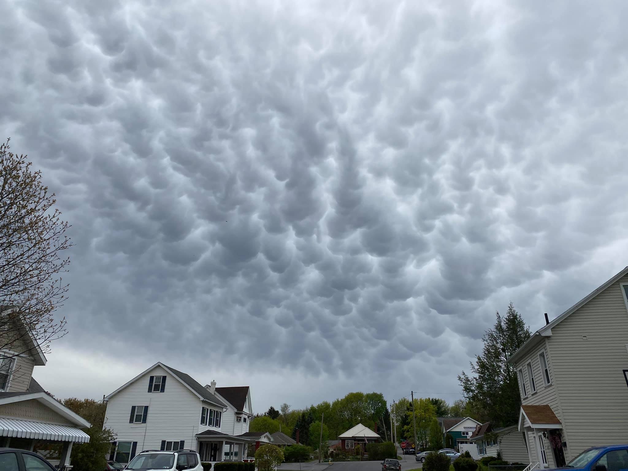
Mammatus Clouds
Mammatus clouds are often seen during severe thunderstorms. The name mammatus is derived from the Latin “mamma,” meaning “udder or breast” and can be thought of as “mammary clouds.” These clouds can be very ominous looking, and there is uncertainty on how they are created. One hypothesis suggests that they are formed when there is a lot of wind shear (the changing of wind direction or wind speed with height) along with sharp gradients in temperature and moisture.
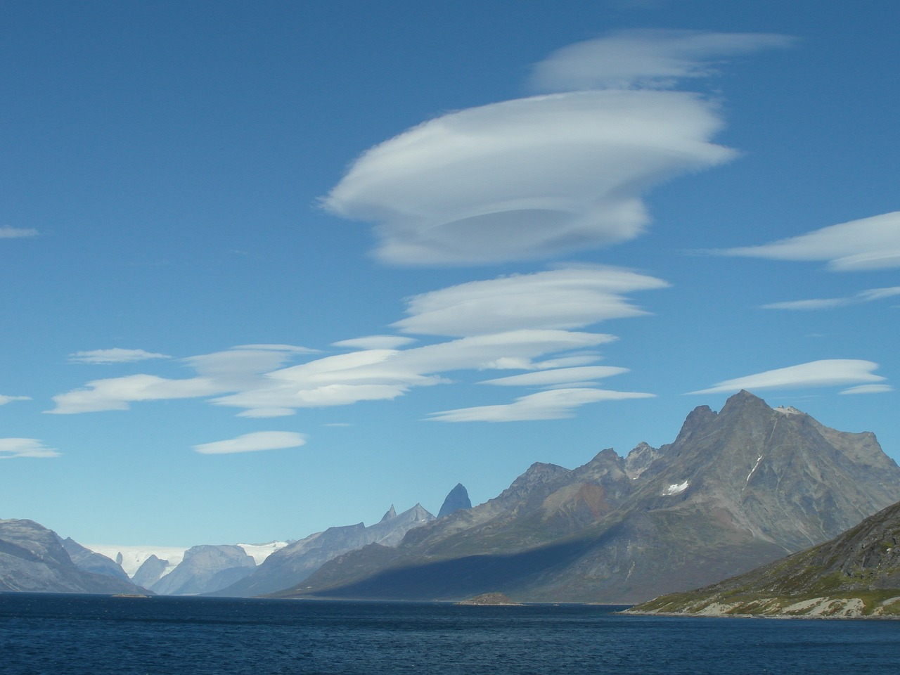
Lenticular Clouds
Lenticular clouds look like UFOs that form in hilly or mountainous areas. These form when moist, stable air flows over an eddy, usually caused by mountains or hills. If the dewpoint and temperature meet and condensation occurs, as the air moves through this eddy, a lenticular cloud is formed, often on the leeward side of the mountain. Some people believe that these clouds are responsible for UFO sightings.
Arcus Clouds
Arcus clouds are low-horizontal cloud formations that often are associated with storm clouds. Many people are familiar with shelf clouds that form along the gust front or leading edge of a severe thunderstorm. Shelf clouds are just one type of arcus cloud. Another type is called a roll cloud. This is similar to a shelf cloud, but it is not attached to a cloud base. They can form with sea breezes and cold fronts without thunderstorms present.

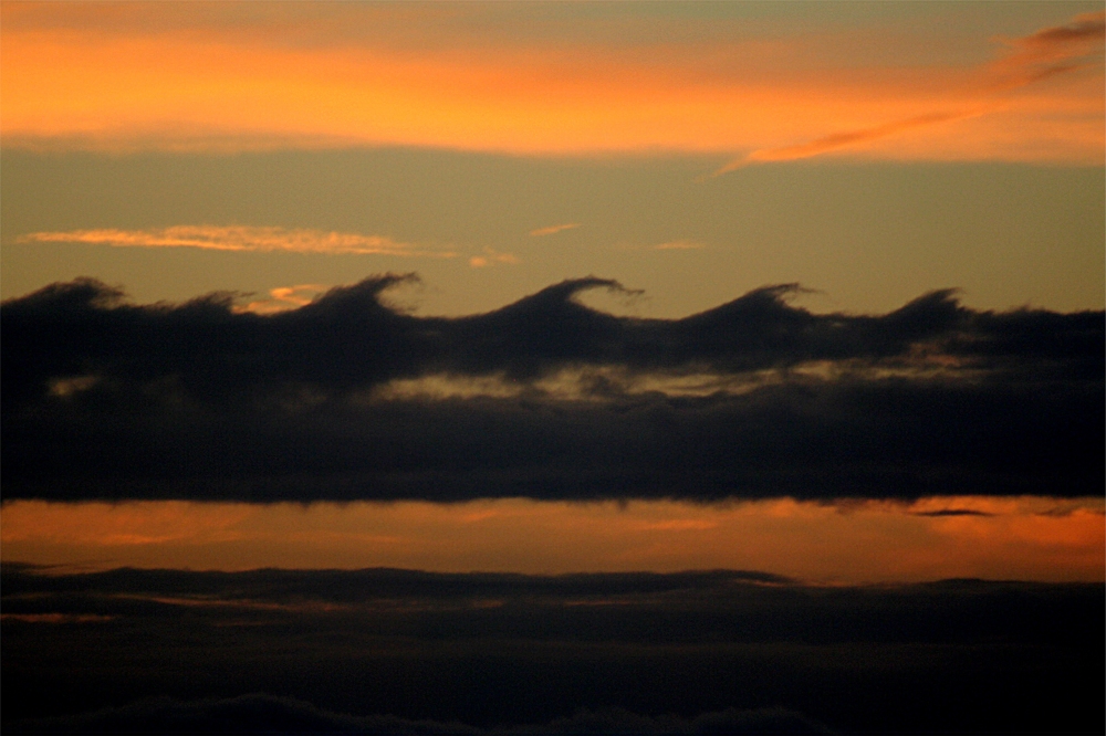
Kelvin-Helmholtz Instability Clouds
The name of this cloud type is a mouth-full “Kelvin-Helmholtz Instability Clouds.” These rare clouds get their name from the physicists who studied turbulent airflow, Hermann Helmholtz and Lord Kelvin. They can occur on windy days when you have different wind speeds at different heights. Per the UK Met Office: “When the upper layer of air is moving at a higher speed than the lower-level air, it may scoop the top of an existing cloud layer into these wave-like rolling shapes. Kelvin-Helmholtz instability is a scientific phenomenon not exclusively associated with clouds.”
Have you seen any of these clouds we talked about in our article? If so send us your photos to our Facebook and Twitter @thestormreport or use the hash-tag: #meteomonday.
Sources: