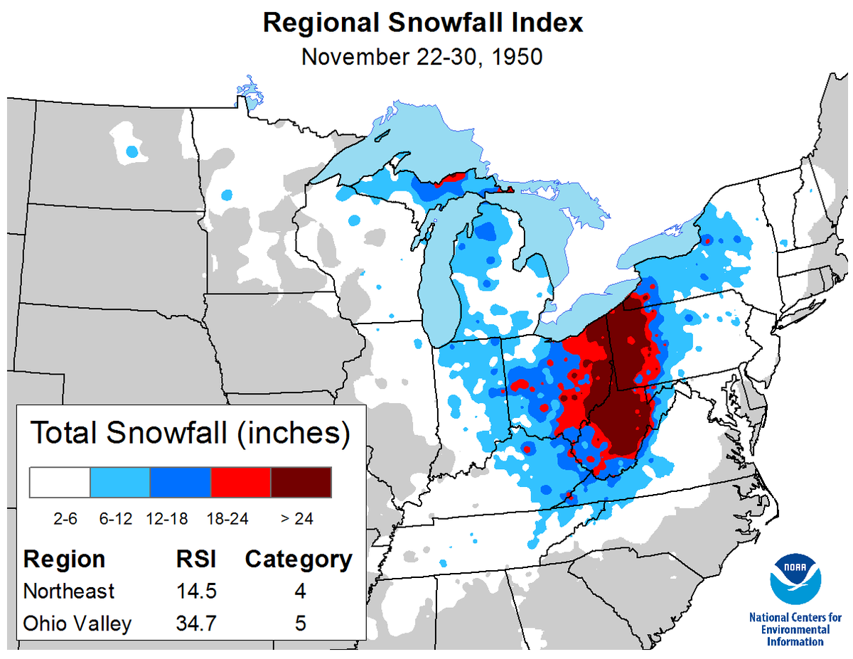
During Thanksgiving weekend in 1950, a long-lasting winter storm meandered its way across the Ohio Valley and Northeast. The storm developed on November 24 and moved off the coast of New England on November 29. It ranks as the worst snowstorm to affect the area.
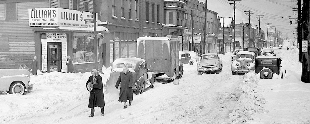
This major snowstorm unfolded across the Ohio Valley, with a large area picking up over 30” of snow over a 3-day period. A whopping 62” of snow fell on Coburn Creek, WV. Pittsburgh, PA received 27.4” of snow, which to this day is the biggest snowstorm to affect the city!
Hurricane-force winds battered the coastal regions of the northeast and New England. These winds caused extensive tree damage and power outages. There was a 94 mph wind gust in New York City and a 108 mph wind gust in Newark, NJ. Even higher wind gusts occurred in the mountains. Bear Mountain, about 40 miles north of New York City, had 140 mph wind gusts, and there was a 160 mph wind gust at Mount Washington, NH.
Flooding affected several rivers and coastal regions. The Ohio River crested at 28.5 feet, four feet above flood level, in Downtown Pittsburgh. In Cincinnati, OH, it reached 56 feet, which is also four feet above flood stage. The Little Juniata River flooded most of downtown Tyrone, PA. Coastal flooding affected New Jersey, New York, and Connecticut. Runways were left underwater at LaGuardia Airport.
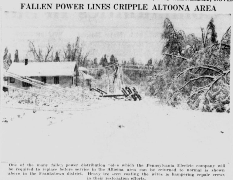
A major ice storm crippled Altoona, PA, beginning on November 24, ending the next morning. As much as four inches of ice accretion caused severe tree and power line destruction in the city. Even high tension, metal, towers were brought down. The city was without power for up to 3 weeks, and most roads were blocked under the fallen trees and wires.
The storm system also brought frigid conditions to the southeast. Temperatures fell to 22°F in Pensacola, FL, 5°F in Birmingham, AL, and 3°F in Atlanta, GA. This record cold led to widespread crop damage, particularly in Georgia and South Carolina.
Sources: