Maybe you’ve experienced this situation. You’re driving down the highway, the weather is fine. You can see some clouds off in the distance, but you’re not concerned. A few miles later, you encounter a sudden white-out with no visibility. Snow and ice cover the road, and your car just slid into the median. You drove right into a snow squall!
In this week’s Meteo Monday, we are looking at snow squalls, particularly “frontal snow squalls”. We will tackle lake-effect snow and lake-effect snow squalls in a future Meteo Monday.

Per the National Weather Service (NWS) Glossary: “A snow squall is an intense, but limited duration, period of moderate to heavy snowfall, accompanied by strong, gusty surface winds and possibly lightning (generally moderate to heavy snow showers). Snow accumulation may be significant.” A frontal snow-squall forms along a “convective line” similar to Quasi-Linear Convective System (QLCS) thunderstorms in the warmer seasons. These low-topped convective cells can be hard to pick up on radar as they typically only grow to 5,000-10,000 feet tall.

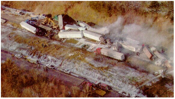
Snow squalls pose an extreme risk to people who are driving on highways. The combination of quickly reduced visibility and sudden slick conditions of the roads often leads to high-speed pile-ups. Sadly many of these wrecks are deadly. Snow squalls are very common in portions of the Northeast. Though they can occur anywhere where a “convective line” can form and the temperatures are cold enough to support snow.
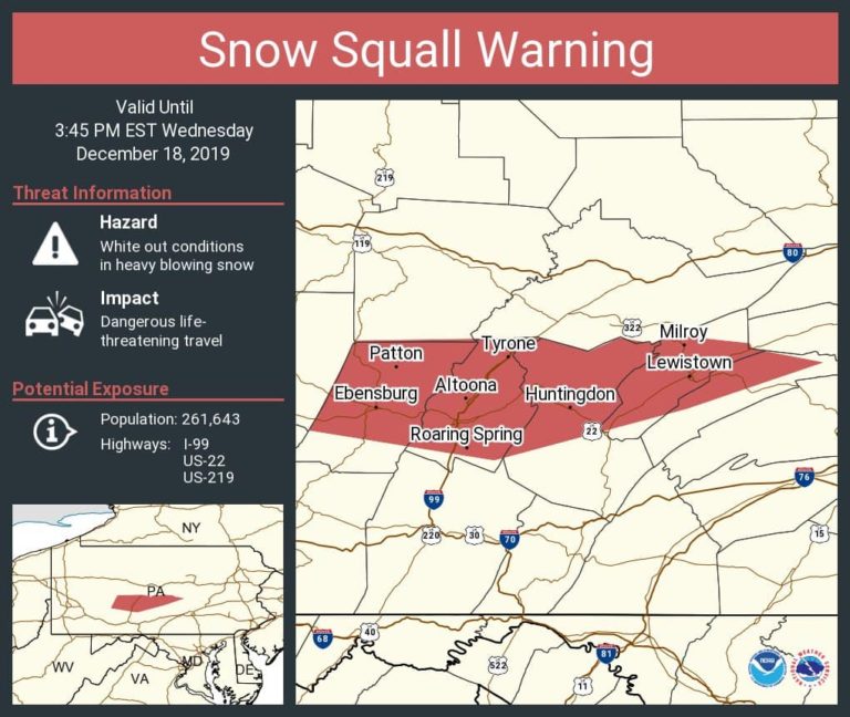
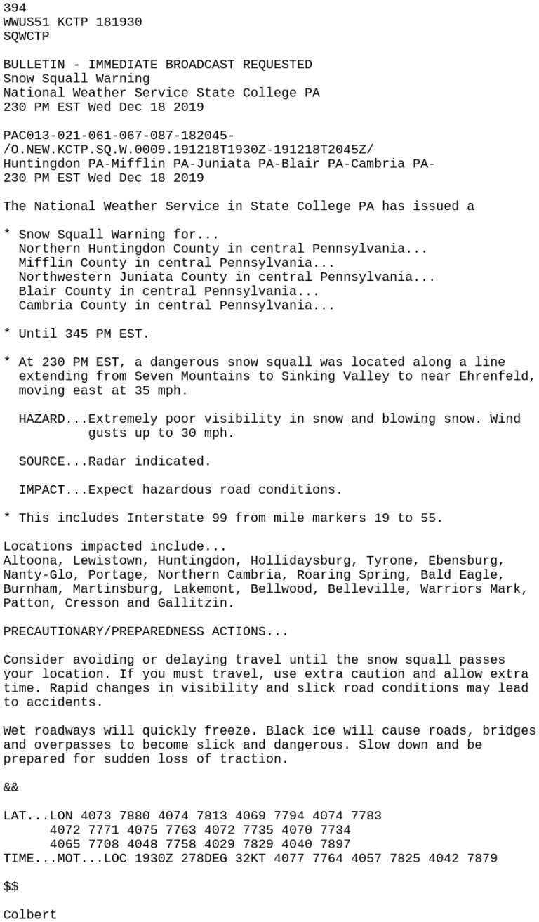
The National Weather Service will issue snow squall warnings for intense squalls. Per the NWS: “A snow squall warning is a short-fused warning product (normally 30-60 minutes) used to warn of an intense, short-lived burst of heavy snowfall. They will be issued for a combination of quick reduction in visibilities (less than 1/4 mile), sudden whiteout conditions, and slick/hazardous roads.” Snow Squall Warnings will trigger the Wireless Emergency Alert (WEA) on your phone, similar to tornado warnings. Not all snow squalls will get a warning.
What should you do if you’re caught in a snow squall? The best thing to do is to avoid all travel. So if you can, delay your travel until after it passes. However, if you’re already on the road when a squall strikes, here are a few things to do to stay safe.
- Slow down! The slower you’re going, the easier it will be for you to stop if you need to.
- If you are having trouble seeing, pull off to the side of the road until visibility improves. Turn off your lights and use your parking brake so another car won’t mistakenly follow your tail/brake lights and end up hitting you.
- If your car starts to slide, stay calm! Ease your foot off the gas and turn your wheels in the direction you want the car to go. If your car is equipped with an anti-lock braking system (ABS), do not pump the brakes, apply steady pressure to the brake pedal.
Winter is upon us and snow squalls are just one of the many hazards of wintry weather! Being prepared and knowing what to do in the event of a squall to stay safe is a must if you’re in an area that deals with them frequently!
Sources
https://w1.weather.gov/glossary/index.php?word=Snow+squall+
https://www.weather.gov/ctp/HISA
https://www.weather.gov/media/iln/winter/SnowSquallBrochure.pdf
https://www.weather.gov/media/iln/winter/SnowSquallBrochure.pdf
https://www.weather.gov/bou/watchwarningadvisoryexplained
https://mesonet.agron.iastate.edu/vtec/#2019-O-NEW-KCTP-SQ-W-0009/USCOMP-N0Q-201912181930