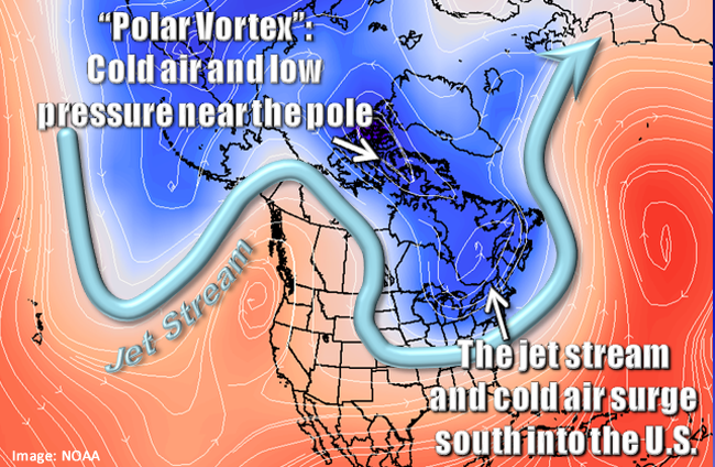
Over 100 million Americans are currently under winter-related watches, warnings, or advisories as a significant winter storm moves out of the Pacific Northwest and across the Rockies. This system will be diving through the Plains and Deep South and then moving up through the Ohio Valley and into the Northeast. The Arctic air mass we talked about in last week’s Meteo Monday continues to penetrate further southeast, so not only are we dealing with accumulating snow and ice for several areas across the country but the potential for record-breaking cold.

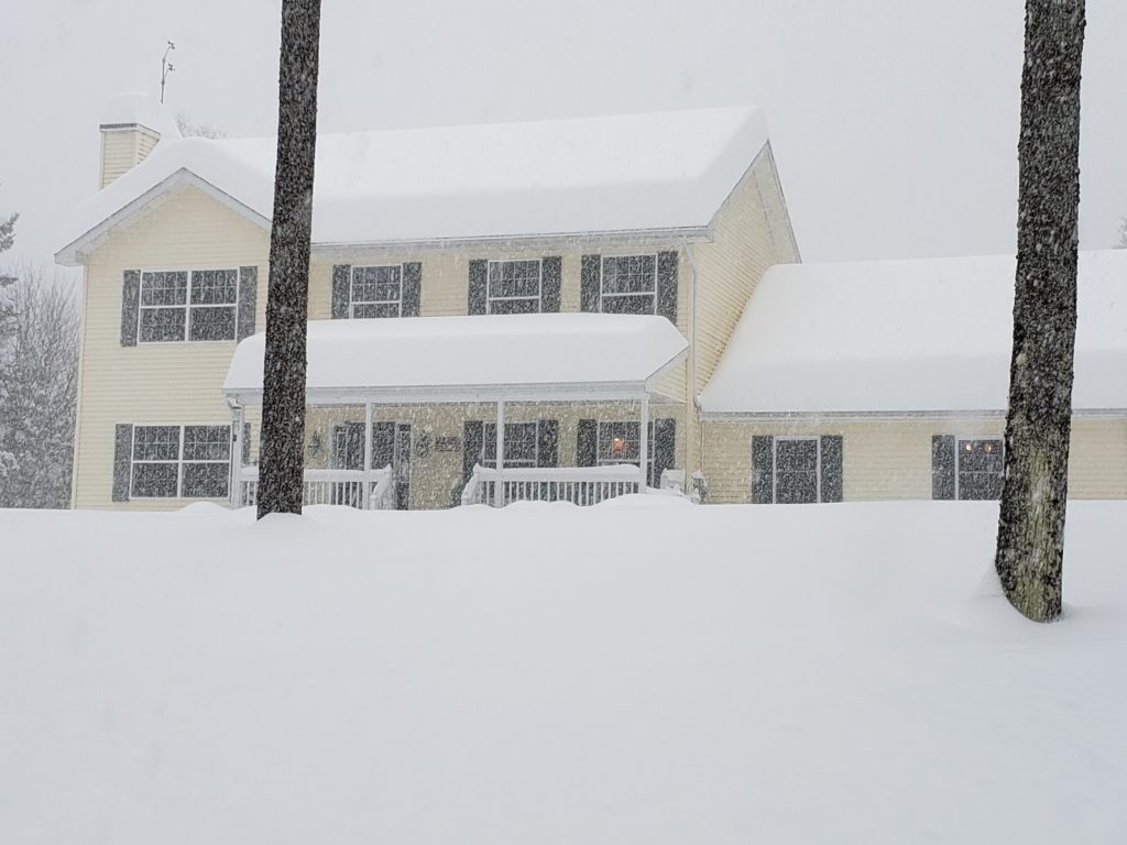
This storm has packed a punch across parts of the Pacific Northwest. Portions of Oregon have picked up over an inch of ice-accretion, which has led to nearly 300,000 power outages. 8-10” of snow has fallen across the Seattle Metro Area, and over a foot has fallen across the Vancouver, WA metro.
CRAZY! The weight of the snow collapses the roof of this boat dock in the Willamette River. House boats tipping, too. At the end of the vid, one man is escaping w/ what looks like a pet kennel! I hope everyone is safe. Caution: language
📷: John Kinsman around 4AM@fox12oregon pic.twitter.com/fETGx8YNzA
— Brenna Kelly (@BrennaKellyNews) February 13, 2021
The National Weather Service in Dallas, TX, is calling this a historic storm. “Major impacts resulting in severe stress to the region`s infrastructure (particularly power, water, and highways) are likely. Regional travel will be crippled for days.” They are also saying that these will be some of the region’s coldest temperatures since the December 1989 Arctic Outbreak.
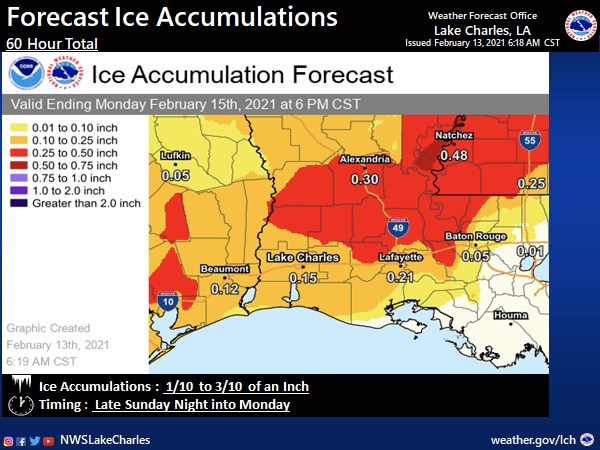
Portions of Louisiana that are still recovering from the devastating 2020 hurricane season will now have to go through a significant ice storm late Sunday night into Monday. NWS Lake Charles is projecting 0.10” to 0.30” of ice accretion across their County Warning Area (CWA). This will lead to tree damage, power outages and make driving impossible.
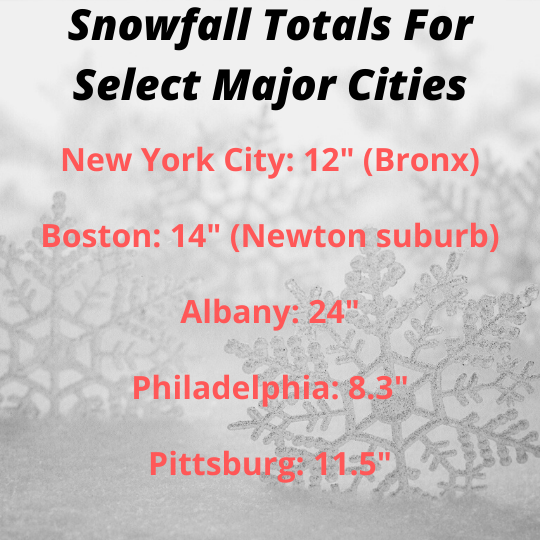
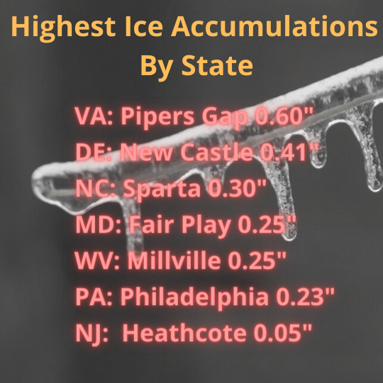
Below are the Weather Prediction Center (WPC) Winter Precipitation Guidance maps. These maps are valid from 7:00 AM EST Saturday through 7:00 AM EST Tuesday. They show the probability of greater than 4” of snow accumulation and ice accumulation greater than a quarter inch.


Not only are we dealing with this winter storm, but there is also a severe weather threat. The Storm Prediction Center has a slight risk (level 2 out of 5) of severe thunderstorms across portions of the Florida Peninsula for Sunday. The main threat is damaging winds, but isolated tornadoes are possible.

Sources: