The Storm Report

  • Home
  • Radio Weather
  • Staff
  • Interactive Radar
  • Contact Us

February 1, 2021 By Nick Wilkes

Meteo Monday – Sharknado!

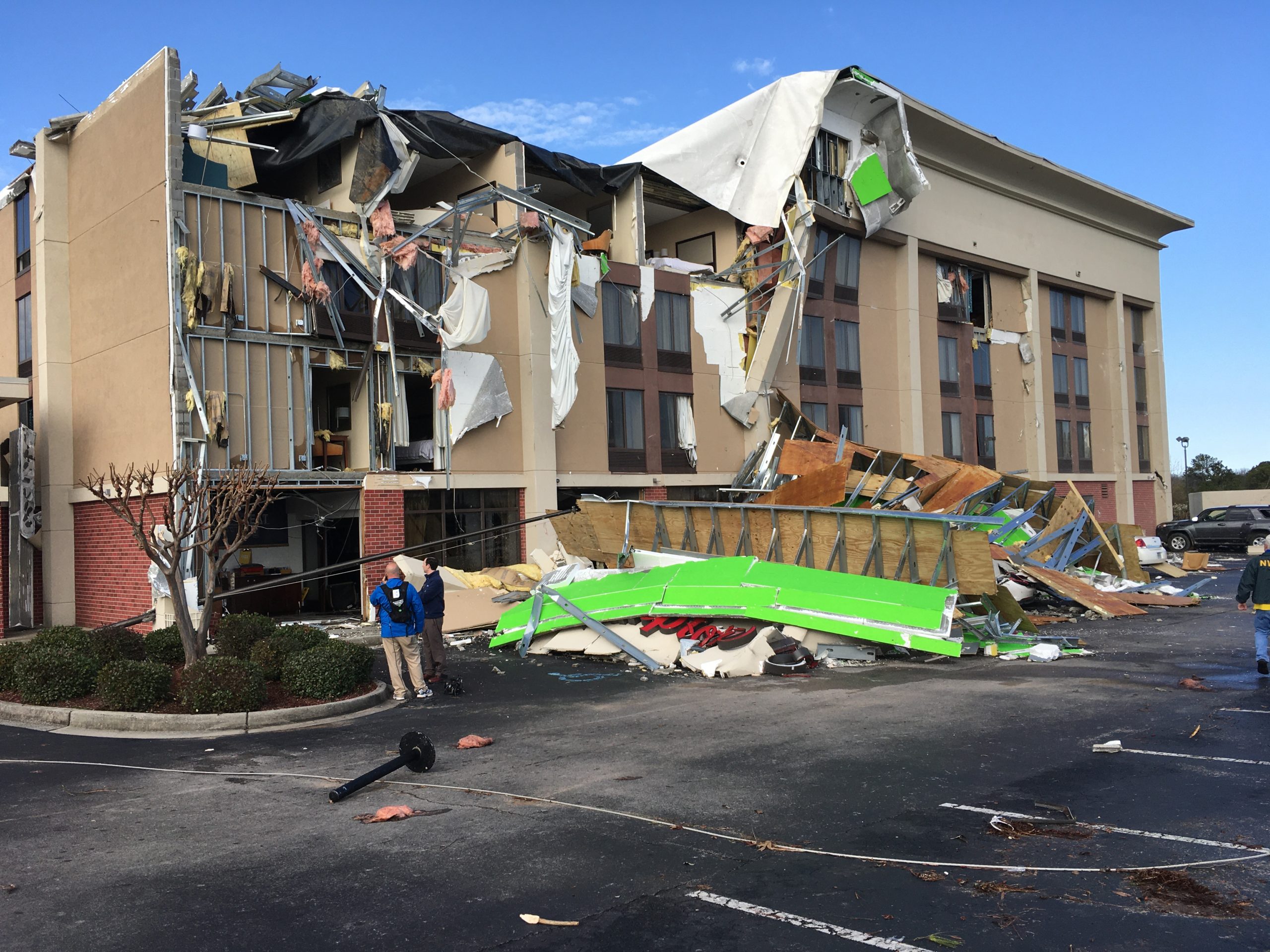
Picture this. It’s July 11, 2013.  You’re getting ready to head to the beach on vacation in a few days, and you’re flicking through the channels while you pack. You stumble upon the SyFy Channel, and you see a tornado throwing sharks at Tara Reid and Ian Ziering! You then ask, can this really happen?? And wonder if the beach vacation should be a Disney vacation instead?


Theatrical release poster via Wikipedia.

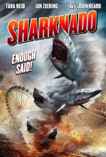
So let’s address the elephant in the room. What is this crazy movie all about? A hurricane is barrelling toward Los Angeles, which causes significant storm surge flooding. The floodwaters are infested with Great White Sharks. As these sharks are swimming through the streets of LA, eating people, three tornadoes develop over the storm surge. Instantly, the sharks are sucked up into the funnels, and thus the sharknado is born! The cast of the movie is left to destroy the sharknadoes and save the city.

Now you may be wondering, can a sharknado actually happen? Well, the answer is “kind of.” You could technically have a “sharknado,” but it won’t be anything like the movie. First, you would need a waterspout. Waterspouts are pretty much tornadoes over water. Most of the time, they stay out to sea but can come on land and cause damage. The National Weather Service (NWS) issues tornado warnings for landfalling waterspouts. Per the National Oceanic and Atmospheric Administration (NOAA). Waterspouts fall into two categories: Tornadic waterspouts and fairweather waterspouts.


Waterspouts over Lake Michigan, via NWS Gaylord.

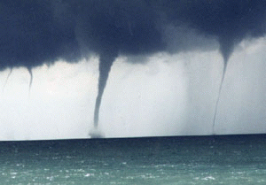
Waterspouts have been known to suck up a school of fish swimming close to the water’s surface. The fish, or in some cases frogs and worms, are then carried up into the storm’s updraft and can rain down miles away from where they originated. Theoretically, it is possible that small sharks could get pulled up into a waterspout’s updraft, which I guess would make it sharknado. However, this isn’t as dramatic as the movie would suggest. It is also unlikely that a 2,000 pound, 20 foot long Great White Shark will be sucked into the waterspout. So, go ahead pack for that beach vacation.  If you see a waterspout, you shouldn’t have to worry about sharks being hurled at you. Although you might need to watch out for those pesky umbrellas that go dancing down the dunes. 

https://youtu.be/BVXEcplcpUg?t=131

Sources:

Sharknado – Wikipedia

Is a real-life ‘Sharknado’ possible?

Science – Waterspouts

Fun Facts About Great White Sharks

What is a waterspout?

Filed Under: blog-3

January 27, 2021 By Nick Wilkes

Deadly Tornado Strikes Alabama

A deadly tornado hit the Birmingham suburbs of Fultondale and Center Point around 10:40 pm CST,  January 25, 2021. Tragically, a fourteen-year-old Fultondale High School student, Elliott Hernandez, was killed. He was found in the basement of a single-story house that collapsed. At least 30 other people were injured. The tornado had a path length of 9.5 miles and a maximum path width of 500-yards.


A home in Fultondale that was leveled. Image via NWS Birmingham.

Working on video, but here’s a quick picture I got of the tornado crossing I65 near Fultondale just north of Birmingham. Extensive damage! @spann @jpdice_Fox6 @jillgilardi @BradTravisWAFF @simpsonwhnt pic.twitter.com/3iVQhSDdN5

— Brad Arnold (@BradArnoldWX) January 26, 2021

NEW: The Fultondale tornado has been given a rating of EF-3 w/ peak winds around 150 mph. Keep in mind that intensity & width varied along its path. The EF-3 damage was focused near Lykes Blvd to New Castle Rd. We will continue to review, but don't anticipate a change in rating. pic.twitter.com/VXZmQY1cG1

— NWS Birmingham (@NWSBirmingham) January 27, 2021

The National Weather Service has rated the tornado as an EF3 on the Enhanced Fujita Scale. They noted that they are still reviewing the damage, but they don’t expect the rating to change. Many homes were damaged, and several were utterly destroyed. Vehicles were tossed off of Interstate 65 just west of Fultondale. Near the interstate, a Hampton Inn Hotel was heavily damaged. Several other businesses in this vicinity were damaged or destroyed.  The Fultondale High School sustained moderate damage from the tornado. Ironically, this twister took a similar track to an EF3 that hit on January 23, 2012.


The Hampton Inn that was damaged. Image via NWS Birmingham.

I found this interesting…back on 1/23/2012 there was an EF-3 tornado that started near Center Point & tracked NE toward the Jefferson/St. Clair county line. Last night's likely tornado may have made a similar track, but started near #Fultondale. #alwx #Birmingham @CBS_42 pic.twitter.com/A6qVVhnBGF

— Dave Nussbaum (@Dave_Nussbaum) January 26, 2021

A tornado warning was issued at 10:34 pm CST, 11 minutes later, at 10:45 pm, the alert was upgraded to a “Particularly Dangerous Situation” (PDS) Tornado Warning. Radar showed that debris was being lofted into the air.  At the Darlene Estates in Fultondale, Adam Sessums tweeted that his weather radio alerted him to the tornado, and he and his family were able to get to safety. A large wooden plank was speared through the wall landing into his bed. 


Radarscope screenshot taken by the author showing the debris signature on the correlation coefficient and the velocity couplet at 10:47 pm CST.

Got my wife and baby out of bedroom about 10 minutes b4 this happened. We r in Darlene Estates in Fultondale. Thank u weather radio! @spann pic.twitter.com/VFBWArlfSG

— Adam Sessums (@MSUZeppfan) January 26, 2021

This is what it looked like as the tornado hit Fultondale, AL around 10:40 PM local time in Alabama Monday Night. What you're seeing are transformers being blown as the tornado rips through power lines & other structures in the area. #alwx #tornado pic.twitter.com/eFWqfNiYBb

— WeatherNation (@WeatherNation) January 26, 2021

NEW VIDEO—
(FULTONDALE, Ala.)

Sunlight shows depth of damage from possible tornado on New Castle Rd. Rescue crews will attempt 2nd search mission soon. 1 death confirmed so far. 17 ppl rushed to hospital. @spann @abc3340 pic.twitter.com/HpTXriYu2U

— Stoney Sharp (@StoneySharp3340) January 26, 2021

@spann @jpdice_Fox6 Aerial shots my dad has taken of Darlene Estates pic.twitter.com/jRA5bK8Bq9

— Pachi (@moon2pachi) January 26, 2021

WOW: the power of the tornado’s winds last night embedded this baseball cap into a wall of this home on New Castle road pic.twitter.com/TAueQIBqDu

— Jonathan Hardison (@FOX6Hardison) January 26, 2021

https://www.youtube.com/watch?v=y5CrptZXPdAhttps://www.youtube.com/watch?v=QONQivpTMg4&t=4shttps://www.youtube.com/watch?v=BG3o-im_Gd0https://www.youtube.com/watch?v=kHz2natqkJ4

Sources:

Tornado leaves significant damage in northeastern Jefferson County

14-year-old dead after tornado tears through Fultondale neighborhood

Tornado kills one, tears swath of damage through Fultondale

Coroner identifies teen killed in collapsed home during tornado in Fultondale

Filed Under: blog-3

January 25, 2021 By Nick Wilkes

Meteo Monday – Ice Jams

It’s time for Meteo Monday, and this week we’re going to get cold and wet as we take a look at ice jams! Although “ice jam” sounds like the name of a punk rock band, it is a destructive meteorological phenomenon.

https://www.youtube.com/watch?v=VEq2CDtAp3s

Ice jams are sometimes referred to as “ice dams,” which is essentially what they are. They are most common in late winter and early spring. If a river is frozen, the warming temperatures (usually coupled with heavy rainfall) will cause the ice to break up. The river then carries the large ice chunks downstream. What happens when this ice collides with an obstacle in its path, such as a bridge, a fallen tree, or sometimes just a narrow passage in the river? The ice will “jam up” beneath or around the offending object(s). 


Ice jam on the Rocky River in Cuyahoga County, Ohio, from National Weather Service.

Once an ice jam occurs, the river’s water has nowhere to go. Thus it backs up and will inundate the area with cold, icy water. Flooding doesn’t just occur upstream of the blockage. Sometimes if the dam bursts, all of the water that was backed up is now forced through and will cause flooding downstream.


Ice jam flooding in Eagle, Alaska, caused by the Yukon River, from National Park Service.

When the ice jam is broken up, and the water recedes, the area that was once flooded will often be littered with “ice cakes.” These chunks of ice are shaped like slices of cakes. However, they are not edible. 


Photo of ice cakes left behind when the water recedes, via Wikimedia Commons.

According to the National Oceanic and Atmosphere Administration (NOAA), weather satellites can help monitor the progress of flooding caused by ice jams. They state: “Satellites in the Joint Polar Satellite System (JPSS) orbit the Earth from pole to pole, eventually seeing every part of our planet twice a day. One JPSS instrument, called the Visible Infrared Imaging Radiometer Suite (VIIRS), can capture images of surface water on Earth. Because JPSS passes over each location on Earth approximately every 12 hours, the data it collects can show how a flood is progressing and where flooding is the worst. This information can assist local emergency responders in figuring out which areas they’ll need to help first.”


“Data and imagery from the Suomi NPP satellite VIIRS instrument aided in observing a major ice jam on the Yukon River that caused massive flooding in Galena, Alaska. Credit: NOAA”

Sources:

Ice jam – Wikipedia

What Is an Ice Jam? | NOAA SciJinks – All About Weather

Filed Under: blog-3

January 19, 2021 By Dan Holiday

Preparing A Storm Chaser Playlist


audio-cassette-909051_1920

January is when we meander through the winter doldrums.  This year a pandemic has made it even more confining.  But just like a nine-year-old in November who makes a Christmas list, we are making one of our own too.

Storm chase season is just around the corner.  And while last year’s road trips left much to be desired, there is always a chance this year might be more active with severe weather. 

In the 90’s we could have created our own cassette mixtapes of cool weather songs.  You know, the perfect mood music to witness Mother Nature at work.  Thirty years ago, we didn’t have the technology we had today.  Listening to a mixtape would have taken away from monitoring AM/FM weather coverage, NOAA weather radio, a Bearcat police scanner, and thumbing through a Rand McNally road atlas. That’s truly how we found our way to bad weather.

Having Internet access in your vehicle has changed it all.  So, while browsing computer models, upper-level data, and real-time radar this May, it’s plausible you need a storm chase soundtrack for your trip.  That’s where we come in. 

These are the top-10 must-have songs for your 2021 playlist: 

#10)  ‘Lightning Strikes’ – Lou Christie – This one may not be familiar to the younger generation of storm spotters.   It hit #1 in 1966.   A few listens, and you’ll catch on.   

https://youtu.be/HaX6ApRyzSI

#9)  ‘Stormy’ – Classics IV – Another 1960’s staple.    More of a mellow tune that might be ideal for the long drive home. 

https://www.youtube.com/watch?v=18Sua_QTDs0

#8)  ‘Ridin’ The Storm Out’ – REO Speedwagon – Perfect to play when you sit in a little blue shed waiting for high winds to subside. 

https://www.youtube.com/watch?v=GVFgEBq0EKM

#7)  ‘Against The Wind’ – Bob Seger – This 41-year-old song lives in every digital jukebox in America.   You may recall it was also featured in the movie “Forrest Gump’ as he went jogging across the country.

https://www.youtube.com/watch?v=PBJRD1VkxmI

#6)  ‘Rock You Like A Hurricane’ – Scorpions – This one would rank at the top if you rode-out Andrew, Camille, or Katrina. 

https://www.youtube.com/watch?v=6yP1tcy9a10

#5)  ‘Oklahoma – Wheatfield’  – From the Twister Motion Picture Score – It is one of two instrumental selections among our downloads.   Perfect for the first track on your trip.   You can’t help but think of Bill Paxton and Helen Hunt as the music soars.

https://www.youtube.com/watch?v=VrPe3J82elk

#4)  ‘Respect The Wind’ – Eddie and Alex Van Halen  – The second of two songs from the 1996 movie ‘Twister’ that made our special playlist.   This track with no-vocals is truly the dark side of nature.

https://www.youtube.com/watch?v=nP6nKTu6TGY

#3)  ‘Tornado” – Little Big Town – Country music represents.   Like most songs, this one is about a relationship but uses all the weather lingo to be a perfect pick.  

https://www.youtube.com/watch?v=iaEmQJG2HHU

#2)   ‘Thunderstruck’ – AC/DC – Heard at almost every sporting event across the country; this one is near the top of our list.   Best selected when adrenaline is running high.  

https://www.youtube.com/watch?v=v2AC41dglnM

#1)   ‘Riders On The Storm’ – The Doors – Don’t settle for the single version.   Load up the album track, which is just over 7 minutes long.    Best repeated when driving into the first sign of dark clouds.

https://youtu.be/iv8GW1GaoIc

Have a successful and SAFE 2021 storm season!  What’s on your storm chase playlist?

Filed Under: blog-3

January 18, 2021 By Nick Wilkes

Meteo Monday – Winter Precipitation Types

It is that time of the week again, Meteo Monday! In this week’s edition, we are going to take a look at winter precipitation types. Have you ever wondered what the difference is between sleet and freezing rain? Have you ever stepped outside and observed what look like Dippin’ Dots ice cream on the ground? Different layers of warm and cold air between the clouds determine the type of precipitation that reaches the ground.


Precipitation type formation via National Weather Service.

Snow

Most precipitation that forms in winter starts as snow because the top layer of the storm is usually cold enough to create snowflakes. Snowflakes are collections of ice crystals that cling to each other. If the air temperature remains below freezing to the ground, you will get snow.


Snowfall graphic via National Weather Service.

The author’s dog playing in the snow on December 16, 2020.

Sleet

Sleet forms when you have snow that falls through a shallow warm layer of the atmosphere. As it falls through this layer, it starts to melt. It then falls through a cold layer at the surface, where it refreezes. Sleet is the tiny ice pellets that fall and bounce upon impact. Some people think that sleet is the same as hail. However, this is not true. They may look similar, but sleet is caused by snow melting and refreezing. Hail is generated in a thunderstorm.


Sleet graphic via National Weather Service.

Sleet next to a penny for scale via Runningonbrains from Wikipedia.

Graupel

Perhaps graupel is a type of wintry precipitation that may be new to you. Graupel is formed by convection. In meteorology, convection is defined as “…vertical transport of heat and moisture in the atmosphere, especially by updrafts and downdrafts in an unstable atmosphere. The terms “convection” and “thunderstorms” often are used interchangeably, although thunderstorms are only one form of convection.” Graupel can be thought of as a hybrid between sleet and hail. These Dippin’ Dots from the sky occur when there is very cold air in the upper parts of a shower or squall, and the surface is just above freezing. Because graupel occurs with convection, lightning is often seen. 


Graphic via NWS Wilmington, OH showing the differences between graupel, hail, and sleet.

Was recording the heavy graupel for my Snapchat when in captured lightning on video, and a pretty loud crack of thunder. Thunder-graupel in Altoona!!!! #PAwx @NWSStateCollege @JoeMurgo pic.twitter.com/hgZLNCaNa9

— Nick Wilkes (@nickwilkeswx) April 10, 2020

Freezing Rain

When plain ole’ rain freezes upon contact with the ground, that is freezing rain. Snow falls through a deep warm layer of the atmosphere, turning to rain; however, if the surface temperatures are at or below freezing, the rain doesn’t have time to freeze into pellets. Anything that is at or below freezing, such as trees, powerlines, or even the ground, freeze over instantly as rain touches them. Accumulating ice can weigh down tree branches and powerlines, which leads to power outages.


Freezing rain graphic via the National Weather Service.

Photo was taken by the author, showing ice accretion caused by freezing rain on a sparkleberry bush in Altoona, PA on February 16, 2016.

Sources:

Severe Weather 101: Winter Weather Types

Glossary – NOAA’s National Weather Service

Filed Under: blog-3

  • « Previous Page
  • 1
  • 2
  • 3
  • 4
  • 5
  • …
  • 8
  • Next Page »

Real Personalities

When looking to add a trusted source for weather, you want someone who can connect with your audience.   Our meteorologists are also on-air personalities.    The Storm Report team delivers a fresh sound with relatable information to get through the day.  We are your staff meteorologists.

The Storm Report

Follow us on:

Real Passion

We love weather.   No two days are the same.   That fuels our passion.   When weather is serious, you will hear it in our voices.    No text-to-speech computer forecasts.   No robotic audio.   Humans connect with humans and that is what radio is all about.

Real Life

When your community hosts special events, the weather is always a factor.   We weave timely information into your forecast when it comes to fairs, parades, fundraisers or remote broadcasts.    If your weather is sponsored, we are the spokesperson, helping your client earn results.

Copyright © 2026 thestormreport.com