The Storm Report

  • Home
  • Radio Weather
  • Staff
  • Interactive Radar
  • Contact Us

December 22, 2020 By Dan Holiday

Scientists Are Certain St. Nicholas Will Stay On Schedule This Season

Officials at the North Pole, the home of the legendary Santa Claus, say the world’s most famous elf has rarely encountered a season quite like this one.   After consulting with sleigh scientists, this year’s trip around the world will be similar but remain within seconds of the total flight time in 2019.   

The traveling team of reindeer and elves along with Santa Claus will wear masks and carry plenty of “Santatizer”.  However  the additional weight on board will not be enough to slow dropping off packages and toys.  

“During the Spanish Flu of 1918-1920, Santa Claus was extra careful on his deliveries,” said Odds Bodkins, head of Physics at the University of The North Pole.   “He’s never late for a delivery, no matter what occurs in the world.”    

St. Nicholas has approximately 31 hours to finish his work because there is an overall difference in the Earth’s rotation and time zones.   He visits over 1600 homes per instant, flying at nearly 1800 miles per second which is more than 8000 times the speed of sound.   Bodkins says “most reindeer can only run at 40 miles per hour, because they haven’t consumed the magic dust needed for high speed flight.”

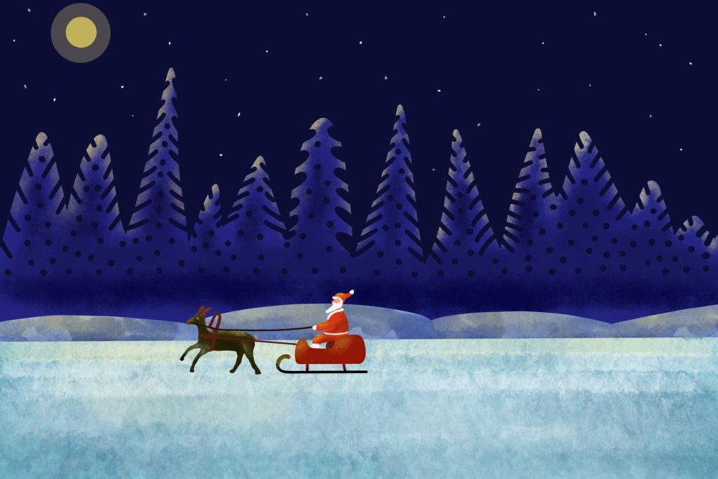
Snow is the one ingredient that assists in Santa’s quick take-offs and landings.   The reduced friction with ice or snow on the ground allows the sleigh to quickly get airborne.    While not every location worldwide has snow, any additional snow will make this year’s journey easier.

“Air traffic control at the North Pole has much better technology than in year’s past.   After a software upgrade, the crew can guide Santa into a strong tailwind which accelerates the overall flight time,” Bodkins said.   

The sleigh is expected to depart the North Pole at around 3:00am Central Standard Time on Christmas Eve.  

Filed Under: blog-3

December 21, 2020 By Jennifer Narramore

Meteo Monday-Frost

A beloved tune during the holiday season is “The Christmas Song”.  It was sung by some of the greats:  Mel Torme, Nat King Cole, Bing Crosby and Perry Como.  And even more recently by Christina Aguilera and Michael Buble. “Chestnuts roasting on an open fire. Jack Frost nipping at your nose.”  Wait.  Who is this Jack Frost character?  And why is he nipping at our noses?  Is he the one that leaves the icy, feathery, pattern on the ground when we get the first near-freezing temperatures of the autumn season?  In this week’s Meteo Monday, we are talking about frost! We will explore the history of the mythical nose-nipper and discuss how frost REALLY forms! 

Jack Frost, much like his counterpart Old Man Winter, is a personification of wintry weather. He is often depicted as a mischievous character that brings in the cold and with that, we get frost, snow, and freezing temperatures.  Jack Frost first made his appearance in English Literature in the 1700s. The book “Round About Our Coal Fire” or “Christmas Entertainments” was published in 1734. It is here that we see one of the first references of Jack Frost. “This time of year being cold and frosty generally speaking, or when Jack Frost commonly takes us by the nose…” From that point on, the frigid fellow has made an appearance in many books, articles, comics, cartoons, songs, television shows, and movies.


19th-century cartoon depicting Jack Frost as a United States major-general during the American Civil War via Wikipedia.

Now, let’s take a look at what frost actually is and how it forms. Per the National Weather Service (NWS) Glossary, frost is described as “the formation of thin ice crystals on the ground or other surfaces in the form of scales, needles, feathers, or fans”.


How do you know when it’ll be a frosty morning? It all comes down to the dew point. Dew point is the way you measure atmospheric moisture. It is the temperature to which the air must be cooled, to reach saturation.  This is how you get dew. If this happens with surface temperatures below freezing, but the temperature within 4-5 feet of the ground is above freezing, the dew freezes on contact. And thus you have frost. Just because the surface temperature is below freezing doesn’t mean you’ll get frost. The temperature must fall to the dew point. Frost typically occurs under a clear sky, with light winds. 

Frost can damage sensitive plants and crops. During the growing season (which varies across the country), the NWS will issue frost advisories if a widespread frost is expected across the area. A frost advisory will be issued when air temperatures are between 33-36℉.  If the temperature is expected to drop below freezing, during the growing season, a freeze warning will be issued instead.


A graph from the NWS explaining the difference between a frost advisory and a freeze warning.

Local topography can also play a role in frost formation. Cold air is heavier than warm air, which will allow it “sink” down into valleys. Valleys will be cooler than the surrounding hill-tops, and therefore frost would be more likely to occur in the valley.

Sources

https://www.weather.gov/arx/why_frost

https://www.weather.gov/ctp/wwaCriteria

https://w1.weather.gov/glossary/index.php?word=Frost

https://writinginmargins.weebly.com/home/a-brief-history-of-jack-frost

https://upload.wikimedia.org/wikipedia/commons/9/98/Round_about_our_Coal_Fire%2C_or%2C_Christmas_Entertainments%2C_4th_edn%2C_1734.pdf

https://en.wikipedia.org/wiki/Jack_Frosthttps://w1.weather.gov/glossary/index.php?word=Dew+Point

Filed Under: blog-3

December 17, 2020 By Nick Wilkes

“The Christmas Star”

Many people know that around December 21 of each year, the Winter Solstice arrives. However, it wouldn’t be 2020 without something out of the ordinary happening! This year during the solstice we are in for a treat, with what many are calling “The Christmas Star.” The conjunction of Saturn and Jupiter will be responsible for this “star.”  It is, however, not actually a star.


Image of the Jovian Planets via Laboratory For Atmospheric and Space Physics as part of a NASA funded initiative.

These two Jovian Gas Giants will appear to merge into one “star”  on the evening of December 21, they however still remain millions of miles apart. The fact that this is occurring on the winter solstice is just merely a coincidence. Conjunctions of planets like this can happen on any day of the year. Henry Throop, an astronomer with NASA said, “The date of the conjunction is determined by the positions of Jupiter, Saturn, and the Earth in their paths around the Sun, while the date of the solstice is determined by the tilt of Earth’s axis. The solstice is the longest night of the year, so this rare coincidence will give people a great chance to go outside and see the solar system.”

If you want to view the conjunction, all you have to do is find an unobstructed view of the southwest sky. When you look up, you’ll see what looks like a large “star” in the sky. Even if you live in a major city, these planets are bright enough to be seen on a typical night, but when they appear to “merge” it will be even brighter and very easy to see.


Graphic via NASA on where to look to view the conjunction.

What makes this one special is that the last time the planets appeared to be this close in the sky was in 1623 and it was dubbed “the Great Conjunction”  by Galileo Galilei who observed it. The last time that a conjunction between Jupiter and Saturn occurred at night was nearly 800 years ago in 1226!  The next one will occur in 2080. So be sure to get outside on the evening of December 21, if weather permits, and check out the “This Christmas Star”!

Sources

http://lasp.colorado.edu/outerplanets/giantplanets_whatandwhere.php

https://www.nasa.gov/feature/the-great-conjunction-of-jupiter-and-saturn

https://www.nationalgeographic.com/science/2020/12/see-rare-great-conjunction-of-jupiter-saturn-on-winter-solstice/

Filed Under: blog-3

December 16, 2020 By Jennifer Narramore

Historic Snowstorm to Paralyze Parts of the Country

A major snowstorm is expected to impact the Mid-Atlantic and Northeast into New England today into Thursday. Winter storm warnings (pink shading in the map below) stretch from northern North Carolina across the Allegheny Mountains through central Pennsylvania, into southern New England. Snowfall rates of 2-4” per hour are possible at the height of the storm along the spine of the Appalachians. This will create extremely difficult travel as the plows cannot keep up with these types of snowfall rates.

The big cities of the northeast will be hammered with a potpourri of wintry weather and some areas may just plain ole rain, some of it heavy. For the Philadelphia area, for example, snow amounts will be significant north and west of I-95 with the downtown area projected to get 6-8 inches. About 20 miles south of Philadelphia near Medford, NJ, less than an inch of snow is expected.  Southern New Jersey into most of central and southern Delaware, mainly heavy rain is forecast. Coastal Flood Warnings have been hoisted for Atlantic City.  One to two feet of inundation above ground level expected in low-lying areas near shorelines and tidal waterways.


Other major metropolitan areas including New York City, Albany, NY, and Worcester, MA are expected to pick up 12-18” of snow! The Boston, MA, area is forecasted to get 8-12” of snow, and minor coastal flooding is also possible. The Baltimore/Washington DC metro area is slated to get 1-3” of snow before switching over to freezing and then rain. The NWS is forecasting up to a quarter of an inch of ice accretion in Baltimore. From Northern Virginia into West Virginia, over a foot of snow is possible especially from the I-81 corridor and westward, as well as near the Mason-Dixon Line.

The track of this system has shifted more north and west, putting the Pittsburgh area at play for 6-12” of snow and slightly higher totals in Eastern Ohio. Any further shift in the track could affect the outcome of snow totals across the region.

The National Weather Service in State College is calling this a “historic storm” for their region. A large swath of central Pennsylvania is expected to pick up 18-24” of snow! Right now this bullseye appears to be just south and east of the I-99 corridor to near the I-81 corridor. Places like Bedford, Huntingdon, Carlisle, and Wilkes-Barre are expected to see this major snowfall. However, places along I-99, such as Altoona, Tyrone, and State College could also shift into that 18-24” range.


Image via NWS State College.

As you can see by the graphic above, some places such as Williamsport could break their all-time two-day snowfall record from this storm! Are you going to be affected by this storm? We would love to see your photos, tweet them to us @thestormreport or post them to our FaceBook! For the latest forecast from the National Weather Service, click here.

Sources: 

The National Weather Service

Filed Under: blog-3

December 13, 2020 By Nick Wilkes

Meteo Monday-Blizzards

In this week’s Meteo Monday, we are taking a look at blizzards! Blizzards are very impactful winter storms, but there are a lot of misconceptions as to what a blizzard actually is. Many people think that any big snowstorm is a blizzard. This is not true. To be a blizzard, a snowstorm has to have blowing snow and reduced visibility. You can have a blizzard with just one to two inches of snowfall accumulation.


A photo taken during a blizzard in Minneapolis, MN, on December 12, 2012. Photo via Wikimedia Commons.

Per the American Meteorological Society (AMS) for a snowstorm to be classified as a blizzard it must reach each of these criteria for three consecutive hours or longer: 

  • Sustained wind or frequent gusts of at least 35 mph or higher 
  • Falling and/or blowing snow that reduces visibility to less than a quarter of a mile (0.25 miles). 

Past criteria included low temperatures of 20℉ or colder, but this is no longer required.

There is also what is known as a ground blizzard. A ground blizzard is caused when an Artic cold front accompanied by strong winds moves across an area that has freshly fallen snow. The wind whips the snow up creating a whiteout. One of the worst blizzards in US history was a ground blizzard on January 12, 1888. Per the NWS: “One of the most infamous ground blizzards was the Children’s Blizzard of 1888, which killed an estimated 235 people in the Great Plains. This ground blizzard was extremely dangerous because it was preceded by unseasonably warm air, which caused people to let their guard down. Many people ventured outside without proper winter clothing, but the relatively warm weather did not last long.”


Some notable blizzards include; 

  • The 1950 Great Appalachian Storm: You can read our retrospective here. 
  • The “Great Blizzard of 1978”:  Also called the “Cleveland Superbomb”, this blizzard produced wind gusts over 100 mph! 
  • The 1993 “Storm of the Century”: This storm brought heavy snow and blizzard conditions from Alabama northward into New England.
  • The Blizzard of 1996: Paralyzed parts of the Eastern U.S. with over four feet of snow.
  • “Snowmageddon” in 2010:  Massive snow and blizzard conditions occurred across parts of the Mid-Atlantic. Dulles Airport had its greatest snow on record, 32.4 inches.

Ironically, there has even been a hurricane-induced blizzard! On October 30th, 2012, the morning after Sandy made landfall in NJ, a blizzard occurred from the mountains of western North Carolina, through West Virginia, into Southwestern PA. Tropical storm to hurricane-force winds and several feet of snow produced widespread damage across this area.


Map from NCDC showing the snowfall totals produced by Hurricane Sandy.

Sources: 

https://en.wikipedia.org/wiki/Blizzard

https://glossary.ametsoc.org/wiki/Blizzard

https://www.weather.gov/safety/winter-ground-blizzard

Filed Under: blog-3

  • « Previous Page
  • 1
  • …
  • 3
  • 4
  • 5
  • 6
  • 7
  • 8
  • Next Page »

Real Personalities

When looking to add a trusted source for weather, you want someone who can connect with your audience.   Our meteorologists are also on-air personalities.    The Storm Report team delivers a fresh sound with relatable information to get through the day.  We are your staff meteorologists.

The Storm Report

Follow us on:

Real Passion

We love weather.   No two days are the same.   That fuels our passion.   When weather is serious, you will hear it in our voices.    No text-to-speech computer forecasts.   No robotic audio.   Humans connect with humans and that is what radio is all about.

Real Life

When your community hosts special events, the weather is always a factor.   We weave timely information into your forecast when it comes to fairs, parades, fundraisers or remote broadcasts.    If your weather is sponsored, we are the spokesperson, helping your client earn results.

Copyright © 2026 thestormreport.com